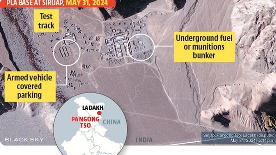
Recent satellite imagery has revealed a concerning development in the ongoing border tensions between India and China. China's military has significantly expanded its presence near the disputed Pangong Lake region in eastern Ladakh, constructing a substantial base with underground bunkers, hardened shelters, and extensive road networks.
The newly revealed base at Sirjap, built on territory claimed by India, serves as a strategic stronghold for Chinese troops stationed in the area. Satellite images, provided by BlackSky, a US-based firm, showcase a large underground bunker with eight entrances, a smaller bunker, and hardened shelters designed to protect military vehicles from potential airstrikes.
This development has raised concerns in India, as it indicates China's intent to solidify its control over the disputed territory. India has responded by focusing on developing its own border infrastructure, including roads, bridges, and airfields, to enhance its military mobility and logistics.
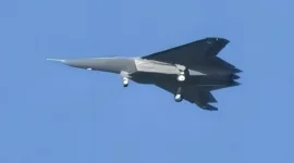
The situation is further complicated by increased military activity at Shigatse air base in Tibet, where China has deployed Chengdu J-20 stealth fighter jets, seen as a direct response to India's Rafale jets.
Additionally, the disputed Doklam plateau has seen a build-up of Chinese military infrastructure, including an extensive road network and troop deployments.
India and China have been engaged in a standoff along the Line of Actual Control (LAC) since May 2020, and this latest development could further exacerbate the situation.