After Completing Extensive Taxi Trials, Indigenous Archer-NG MALE Drone Prepares for First Flight in August 2025

After Completing Extensive Taxi Trials, Indigenous Archer-NG MALE Drone Prepares for First Flight in August 2025


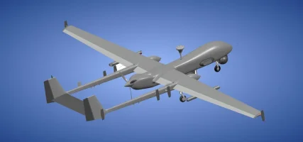
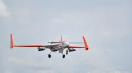
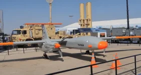
India's indigenous unmanned aerial vehicle (UAV) program has achieved a significant milestone, as the new Archer-NG drone has successfully passed critical ground trials.

The Aeronautical Development Establishment (ADE), a key laboratory under the DRDO, confirmed that the drone has completed both low and high-speed taxi tests, paving the way for its first flight.

The maiden flight is anticipated to take place in the first week of August 2025, following final airworthiness certification from the Centre for Military Airworthiness and Certification (CEMILAC).

The successful completion of high-speed taxi trials is a crucial validation phase in any aircraft's development.

These tests are designed to assess the UAV's performance and stability on the ground at high speeds, verifying the integrity of its airframe, landing gear, braking systems, and engine controls before it is cleared for airborne operations.

This step ensures the aircraft can handle the stresses of takeoff and landing, marking the final stage of pre-flight validation.

The Archer-NG is a Medium Altitude Long Endurance (MALE) drone, designed to operate at altitudes up to 30,000 feet for extended periods.

Powered by a 177-horsepower indigenous turbocharged engine, it boasts an impressive endurance of 29 hours.

With a total weight of 1,800 kg, it is built for persistent intelligence, surveillance, and reconnaissance (ISR) missions over both land and sea, addressing a critical need for long-duration monitoring capabilities for the Indian Armed Forces.

In addition to surveillance, the Archer-NG is equipped for light combat roles.

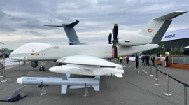
The UAV features two hardpoints capable of carrying a combined weapons payload of 300 kg. This allows it to be armed with a variety of munitions, including precision-guided bombs and air-to-ground missiles, giving it a precision strike capability.

This dual-role function is a key part of India's strategy to develop versatile and cost-effective defence platforms under the 'Atmanirbhar Bharat' (Self-reliant India) initiative.

Developed to fill a strategic gap between smaller tactical drones and the larger Rustom series of UAVs, the Archer-NG is set to provide the armed forces with a versatile platform for a wide range of operations.

Its successful development and induction will enhance India's domestic defence manufacturing capabilities, reduce dependence on foreign imports, and provide a customizable system for border surveillance and targeted military actions.

The upcoming flight in August will be a landmark event for India's growing expertise in unmanned aerial systems.
 
Such UAVs should have a system of navigation, away from satellite based present systems , so intertial navigation , ring laser or like old time star light based systems, which Americans did use in 1950s , star constellation , sun direction can be accurate to great extent for atleast return to base , RTB in case of signal jamming or satellite shoot down . All got imagination, that can come true so ancient knowledge of stars is with us in our text, try put it to this system also.
 
Aecher NG drone has completed High Speed taxi and getting ready for flight by August.
All the good wishes.Complete the certification as soon as possible.
 
Such UAVs should have a system of navigation, away from satellite based present systems , so intertial navigation , ring laser or like old time star light based systems, which Americans did use in 1950s , star constellation , sun direction can be accurate to great extent for atleast return to base , RTB in case of signal jamming or satellite shoot down . All got imagination, that can come true so ancient knowledge of stars is with us in our text, try put it to this system also.
I am genuinely asking this.
Do you have working knowledge on how to incorporate all this in a UAV ? I like the idea, hence asking
 
I am genuinely asking this.
Do you have working knowledge on how to incorporate all this in a UAV ? I like the idea, hence asking
I am lay man but yes I have an idea , since this UAV flies above cloud cover and out of commercial 35000 feet altitude, so if on its top section ,it has a window like a sun roof , it can take photos of sun, stars and constellation , use a magnetic compass along with it and fuse the data to ascertain where it's base might to return safely . My idea is of RTB ,that's return to base , if all communication are down .I hope this may be of use as it's unique but has been tried by Americans in 1950s to guide missile, rest ,like Ring laser and intertial navigation exit and are used all over world .
 
I am genuinely asking this.
Do you have working knowledge on how to incorporate all this in a UAV ? I like the idea, hence asking
It's on net, ICBMs of USA used star constellation to navigate ,once out of communication range in 1950s and they were accurate to 90 m . US may have data and information on this so it can be tapped .
 
Such UAVs should have a system of navigation, away from satellite based present systems , so intertial navigation , ring laser or like old time star light based systems, which Americans did use in 1950s , star constellation , sun direction can be accurate to great extent for atleast return to base , RTB in case of signal jamming or satellite shoot down . All got imagination, that can come true so ancient knowledge of stars is with us in our text, try put it to this system also.
Not able to understand much of it as we have no detailed idea of this comments......

American GPS, or Russian Glonass or Indian NAVIC(Navigation with Indian Constellation) can be utilized for communication if necessary or as to requirement..... NAVIC alone has seven satellites as of now..... It may have spares too, not openly declared......

So all these systems have a group of satellite's... Not a single solid system..... We can rely on them..... NaviC is our own indigenous system..... All the major powers communicate with encrypted data's.... For example L5 band..... NaviC has the range of 1500Kms....

Apart from this you have pseudo satellites, Radio wavelengths of different frequencies from the transmitters etc...

Star wars has not started.... Not to be worried much as we too have these capabilities... ISRO has already achieved it......
What's not begun ,will ,in case we take on China , at present we are facing the problem of Pakistan. What I meant was that , some system that's stand alone, relying on old ways of navigation but with data processing at high speed for doing the navigation in a totally signal jamming and signal denied environment. I am not worried,only imagination based on certain facts, US made ICBM that were to work in a totally signal denied and navigation denied environment and used star constellation navigation as a standard system .so please see net , google it . it do work.
 

Forum statistics

Threads
5,042
Messages
55,398
Members
3,820
Latest member
Umesh Tiwari
Back
Top