India's recent flight test of the Agni-IV intermediate-range ballistic missile (IRBM) has ignited a surprising wave of discussion among military observers in Turkey.
The conversation was triggered when an open-source intelligence analyst, Damien Symon, posted a graphical representation of the weapon's reach on the social media platform X.
This visual map clearly demonstrated that the two-stage, solid-fuelled missile's 4,000-kilometre operational range travels far past South Asia. The strike radius blankets vast swathes of Eurasia, including western China, Central Asia, the Middle East, and stretches all the way to Turkish borders.
Upon its release, the map rapidly went viral across Turkish social media networks. Numerous defence analysts and enthusiasts voiced astonishment that a system engineered by India possesses the capacity to potentially strike their nation.
These regional reactions underscore a broader reality: India's formidable missile arsenal often flies under the radar in international security discussions outside of Asia.
This remains true even as the Defence Research and Development Organisation (DRDO) has spent more than two decades systematically advancing the nation's indigenous ballistic technologies.
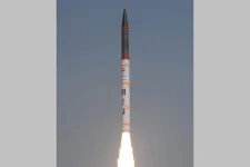
The latest user training trial took place on August 6 from the Integrated Test Range at Dr APJ Abdul Kalam Island (formerly Wheeler Island), located off the coast of Odisha.
Executed by the Strategic Forces Command (SFC)—the tri-services military command responsible for administering the country's nuclear assets since 2003—the launch served as a routine operational validation.
Defence officials confirmed the exercise was a resounding success, successfully meeting all designated mission parameters and verifying the reliability of the system within the country's nuclear framework.
While international headlines frequently focus on the longer-reaching Agni-V intercontinental ballistic missile, the Agni-IV stands as a critical pillar of India's military strategy.
Weighing roughly 17 tonnes and measuring 20 metres in length, it flawlessly bridges the operational gap between the medium-range Agni-III and the intercontinental Agni-V. The weapon grants military planners versatile options to deter threats across the continent.
Technically, it boasts state-of-the-art avionics, a fifth-generation onboard computer, and composite rocket motors. Its pinpoint accuracy is driven by a Ring Laser Gyro-based Inertial Navigation System (RINS) paired with a highly reliable Micro-Navigation System (MINGS), ensuring precision even over thousands of kilometres.
The alarm raised by Turkish commentators was primarily provoked by the stark visual impact of the map, rather than any geopolitical friction or indication that Turkey factors into New Delhi's targeting strategies.
India’s long-standing nuclear doctrine is strictly rooted in a "No First Use" policy and the principle of maintaining a "Credible Minimum Deterrence". The nation's strategic forces are structured strictly to deter aggression from nuclear-armed neighbours in the region, rather than projecting aggressive conventional power globally.
However, the viral graphic illuminated an undeniable truth regarding contemporary aerospace technology. Because intermediate-range ballistic weapons are built to travel between 3,500 and 5,500 kilometres, their operational footprints inevitably encompass massive geographic territories.
As a mathematical consequence, nations situated far beyond the scope of India's immediate security concerns find themselves inside a theoretical strike zone, despite having zero relevance to India's defensive calculations.
This geopolitical chatter also highlights the escalating impact of open-source intelligence (OSINT) on international defence dialogues. Independent researchers and analysts consistently capture global attention by translating highly complex military data into digestible visual graphics.
In this specific scenario, a simple geometric circle drawn over a map vividly translated India's military strength to the public, forcing analysts from regions generally disconnected from South Asian security matters to pay close attention.
India's deterrence capabilities have drastically matured since the early days of the Agni program.
While the road-mobile Agni-IV ensures ironclad regional security, the deployment of the Agni-V has pushed India's reach beyond 7,000 kilometres, easily covering all necessary strategic targets across Asia and parts of Europe.
Furthermore, the DRDO continues to push boundaries, reportedly advancing cutting-edge technologies like Multiple Independently Targetable Re-entry Vehicles (MIRV) to bypass enemy defence systems, while simultaneously enhancing the survivability and launch speeds of their platforms.
Ultimately, the shock expressed by Middle Eastern and European commentators proves that India's military prowess is commanding respect far beyond the borders of the Indo-Pacific.
As New Delhi aggressively modernises its indigenous hardware through rigorous testing and cutting-edge upgrades, its defensive posture is capturing the world's gaze. This continued technological evolution firmly cements India's status as a top-tier global missile power.